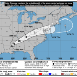
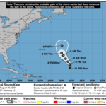
000 WTNT45 KNHC 310233 TCDAT5 Tropical Storm Kate Discussion Number 12 NWS National Hurricane Center Miami FL AL102021 1100 PM AST Mon Aug 30 2021 Kate is a strongly sheared and poorly organized tropical cyclone. Satellite images show an exposed low-level center with a few patches of deep convection on the system's east side. The latest Dvorak classifications range from 25-35 kt, and the initial intensity is held at a possibly generous 35 kt for this advisory. Unfortunately, ASCAT missed the circulation this evening. Strong west-northwesterly shear of about 30 kt is expected to persist into early Tuesday, and that could cause some weakening in the short term. Although the shear is expected to lessen after that, Kate will be moving into a drier and more stable airmass. None of the intensity models show much strengthening, and the global models suggest that Kate could dissipate sometime within the next couple of days. The official forecast is again nudged downward and generally shows little change in strength during the next 4 days. Kate, or its remnants, are likely to merge with an extratropical low and associated front in 4 to 5 days. The tropical storm has moved little during the past few hours, but a 12-hour motion yields an estimate of 360/5 kt. The storm is moving toward a weakness in the ridge caused by a deep-layer low over the North Atlantic, and that motion should continue into Tuesday. By Wednesday, mid-level ridging building to the northeast of the system should cause it to turn northwestward. However, another trough moving eastward over the western Atlantic is expected to cause Kate to turn northward again toward the end of the week. The NHC track forecast follows the various consensus aids and is similar to the previous one. FORECAST POSITIONS AND MAX WINDS INIT 31/0300Z 22.7N 50.9W 35 KT 40 MPH 12H 31/1200Z 23.6N 50.7W 30 KT 35 MPH 24H 01/0000Z 24.8N 50.9W 30 KT 35 MPH 36H 01/1200Z 26.1N 51.8W 35 KT 40 MPH 48H 02/0000Z 27.6N 52.9W 35 KT 40 MPH 60H 02/1200Z 29.1N 54.0W 35 KT 40 MPH 72H 03/0000Z 30.4N 54.8W 35 KT 40 MPH 96H 04/0000Z 33.9N 54.6W 35 KT 40 MPH 120H 05/0000Z...DISSIPATED $$ Forecaster Cangialosi


